Where the Marks Actually Go
Cambridge IGCSE Geography candidates routinely lose marks not because they lack knowledge but because they mishandle the exam itself. Examiner reports for the 0460 syllabus, published after every session, return to the same handful of errors year after year. The patterns are remarkably consistent. A candidate who eliminates even three or four of these recurring mistakes can expect a meaningful improvement in their overall grade, because the marks recovered are spread across multiple papers and topics rather than concentrated in one area.
The mistakes below are drawn from the highest-frequency errors identified across recent IGCSE Geography examination sessions. Each one includes the wrong approach, an explanation of why it loses marks, and a corrected technique.
Mistake 1: Misreading Command Words
Every question on a Cambridge IGCSE Geography paper begins with a command word that dictates the type and depth of response required. Candidates who treat all questions as if they say "write about" lose marks systematically, because the mark scheme is built around the command word, not the topic.
| Command Word | What Candidates Often Do | What the Mark Scheme Requires |
|---|---|---|
| Describe | Explain causes or give reasons | State what is shown or what happens, using data or evidence from the resource. No reasons needed. |
| Explain | Simply describe without giving reasons | Give reasons or causes. Each point must include a "because" or "this leads to" element. |
| Suggest | Recall textbook facts without applying them | Apply geographical knowledge to an unfamiliar situation. Accept reasonable inferences, even if not explicitly taught. |
| Evaluate | List only advantages or only disadvantages | Weigh both sides of an argument and reach a supported conclusion. One-sided answers are capped below the top band. |
| Compare | Describe each item separately | State similarities and differences using comparative language: "higher than," "whereas," "both." |
Wrong vs. correct: a describe question
Question: Describe the distribution of the world's largest cities. [3 marks]
| Wrong Approach (0-1 marks) | Correct Approach (3 marks) |
|---|---|
| "There are lots of big cities because people move there for jobs and services. Urbanisation happens when countries develop economically." | "The largest cities are concentrated in Asia, particularly in China, India, and Japan. There are clusters along coastlines and major river valleys. Fewer of the largest cities are found in Africa and South America, and very few in Australasia." |
| This answer explains rather than describes. No data or spatial patterns are given. | This answer identifies location, pattern, and distribution using the map evidence. No explanation is needed or rewarded. |
Mistake 2: Incomplete Explanations That Stop at One Link
IGCSE Geography mark schemes for explanation questions award marks along a chain of reasoning. A single statement earns one mark. A developed chain, where each point leads logically to the next, earns two or three. Candidates who write several separate, undeveloped points instead of extending one point into a full chain consistently underperform.
Wrong vs. correct: an explain question on river flooding
Question: Explain why deforestation in the drainage basin increases the risk of flooding. [4 marks]
| Wrong Approach (1-2 marks) | Correct Approach (4 marks) |
|---|---|
| "Trees are cut down. Water goes into the river faster. There is more flooding." | "Deforestation removes the tree canopy that would normally intercept rainfall before it reaches the ground (1 mark). Without interception, more water reaches the soil surface directly, increasing surface runoff because the soil becomes saturated more quickly (1 mark). The increased runoff reaches the river channel faster, raising the discharge over a shorter period (1 mark). This produces a higher peak discharge on the flood hydrograph, which is more likely to exceed the bankfull capacity and cause flooding downstream (1 mark)." |
| Three separate statements with no linking. The examiner sees three attempts at one mark each, but only two are creditworthy because "water goes into the river faster" lacks a mechanism. | A single chain of reasoning with four linked steps: interception lost, surface runoff increases, discharge rises faster, flooding results. Each link earns one mark. |
Mistake 3: Calculation Errors in Fieldwork and Data Questions
Papers 2 and 4 of the IGCSE Geography examination frequently require candidates to read values from graphs, calculate percentages, measure distances on maps, or interpret statistical data. The arithmetic itself is rarely difficult, but candidates lose marks through three recurring errors: misreading the scale, failing to show working, and dropping units.
Common calculation pitfalls
| Error | Example | How to Avoid It |
|---|---|---|
| Misreading a graph scale | Reading 350 as 300 on a vertical axis where each grid line represents 50, not 100 | Before reading any value, check what one small division on the axis represents. Write it in the margin. |
| Omitting units | Writing "the distance is 4.5" instead of "4.5 km" | Circle the unit in the question and include it in the final answer. On map questions, state the scale conversion used. |
| Not showing working | Writing only the final answer for a percentage change calculation | Write the formula, substitute the values, then calculate. Method marks are available even when the final number is wrong. |
| Measuring map distance incorrectly | Using a ruler on a curved river and getting a straight-line distance instead | For curved features, use the edge of a piece of paper, marking off short straight segments, then measure the paper against the scale bar. |
Example - percentage change: If a town's population grew from 24,000 to 30,000, the percentage increase is calculated as: (30,000 - 24,000) / 24,000 x 100 = 25%. Candidates who write only "25%" with no working risk losing the method mark if a copying error produces the wrong figure. Candidates who write "6,000 / 30,000 x 100 = 20%" have used the wrong denominator (the new value instead of the original), and because no working is shown, the examiner cannot distinguish a formula error from an arithmetic slip.
Mistake 4: Vague Answers on Coastal Processes
Physical processes that shape the coast is a core topic in IGCSE Geography, and it generates a distinctive type of error. Candidates know that erosion, transportation, and deposition occur, but they frequently fail to name the specific processes within each category. Writing "the sea erodes the cliff" is not sufficient. The mark scheme requires candidates to identify whether the erosion is hydraulic action, abrasion, attrition, or solution, and to describe the mechanism of each.
Wrong vs. correct: coastal erosion processes
| Wrong Approach | Correct Approach |
|---|---|
| "The waves hit the cliff and wear it away over time. The rocks break and fall into the sea." | "Hydraulic action occurs when waves compress air into cracks in the cliff face; the repeated pressure widens the cracks and eventually dislodges blocks of rock. Abrasion happens when waves hurl sand and pebbles against the cliff face, scraping and wearing away the rock surface. Attrition is the process by which rocks carried by the waves collide with each other and are broken into smaller, rounder fragments." |
The same precision requirement applies to coastal landform formation. A question asking candidates to explain how a headland and bay form expects reference to differential erosion of alternating bands of resistant and less resistant rock, not simply "the sea erodes the coast unevenly."
Mistake 5: Confusing Factors That Influence Where People Live
Settlement and population distribution questions require candidates to distinguish between physical factors (relief, climate, water supply, soil fertility, natural resources) and human factors (employment, transport links, political decisions). A common error is listing factors without linking them to the specific location in the question. Another is confusing reasons for settlement location with reasons for population growth, which are related but distinct topics.
Candidates also lose marks by stating a factor without explaining its effect. "The area has a good climate" is identification. "The warm temperatures and reliable rainfall allow year-round agriculture, which supports a higher population density" is explanation. The second version earns more marks because it traces the connection between the factor and the outcome.
Mistake 6: Treating Urbanisation as a Single Process
Questions on the opportunities and challenges of urbanisation require candidates to distinguish between several related but separate processes: urbanisation itself (the increasing proportion of a country's population living in urban areas), rural-to-urban migration (one driver of urbanisation), counter-urbanisation (movement away from cities), and suburbanisation (growth of the urban fringe). Candidates who conflate these terms or use "urbanisation" as a blanket word for all of them lose precision marks.
Topic-specific misconceptions in urbanisation
| Misconception | Correct Understanding |
|---|---|
| Urbanisation only happens in LEDCs | Urbanisation rates are currently highest in LEDCs, but the process occurred historically in MEDCs during industrialisation. Many MEDCs are now experiencing counter-urbanisation. |
| All urban growth is caused by rural-to-urban migration | Natural increase (births exceeding deaths) within cities also contributes significantly to urban growth, particularly in LEDCs where urban populations tend to be young. |
| Squatter settlements have no positive features | While squatter settlements lack formal services and legal tenure, they often develop strong community networks, informal economies, and self-built improvements over time. Mark schemes reward balanced evaluation. |
Mistake 7: Muddling River Processes and Landforms
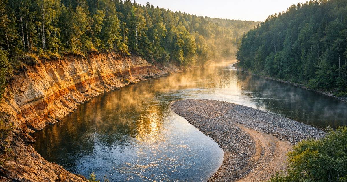
The hydrological characteristics and processes operating in rivers and drainage basins form a substantial part of the IGCSE Geography syllabus. Candidates frequently confuse the processes themselves (erosion types, transportation methods) with the landforms they produce (meanders, oxbow lakes, floodplains, deltas). A precise answer links the process to its outcome.
Four river transportation processes appear on mark schemes repeatedly, and candidates often name only one or two, or mislabel them entirely.
- Traction: Large boulders and rocks rolled along the river bed by the force of the water.
- Saltation: Smaller stones bounced along the river bed in a hopping motion.
- Suspension: Fine particles of silt and clay carried within the body of the water, giving it a brown or muddy appearance.
- Solution: Dissolved minerals carried invisibly in the water, particularly in limestone areas.
A common error is confusing the river erosion process of abrasion (rocks scraping the river bed and banks) with the coastal erosion process of the same name. The mechanism is similar, but the context and the specific way examiners expect the answer to be framed differs. In river contexts, abrasion is sometimes called corrasion, and candidates should be prepared to see either term on a mark scheme.
Mistake 8: Poor Time Management Across the Paper
IGCSE Geography papers have strict time constraints, and candidates who overwrite on early questions routinely leave later questions incomplete or unanswered. The mark-per-minute ratio should guide time allocation.
| Paper | Duration | Total Marks | Approximate Time Per Mark |
|---|---|---|---|
| Paper 1 (Geographical Themes) | 1 hour 45 minutes | 75 | 1.4 minutes |
| Paper 2 (Geographical Skills) | 1 hour 30 minutes | 60 | 1.5 minutes |
| Paper 4 (Alternative to Coursework) | 1 hour 30 minutes | 60 | 1.5 minutes |
A 6-mark question on Paper 1 should take approximately 8 minutes. Spending 15 minutes on it, however thorough the answer, means the equivalent time is stolen from another question where those marks might have been easier to secure. The marks lost from an unanswered final question are almost always greater than the marks gained from perfecting an earlier one.
A practical technique: before beginning the paper, scan all questions and note the mark allocation beside each. Divide the total time by the total marks to establish a per-mark rate, then note a target finish time beside each question. This discipline prevents the common pattern of diminishing returns as the paper progresses.
Mistake 9: Ignoring the Resource Material
IGCSE Geography papers are resource-heavy. Candidates are given photographs, maps, graphs, tables, and diagrams, and the mark scheme expects answers to reference these materials directly. A candidate who answers from memory, ignoring the photograph of a squatter settlement that accompanies the question, loses the application marks that often constitute half the available total.
Specific resource-reading errors include:
- Failing to quote data from a graph or table when the question says "using the data provided."
- Describing a photograph in vague terms ("it looks poor") instead of identifying specific visible features (corrugated iron roofs, unpaved roads, open drainage channels, lack of formal infrastructure).
- Reading a four-figure grid reference when the question asks for a six-figure reference, or vice versa.
- Misidentifying contour patterns on an Ordnance Survey or topographic map extract, particularly confusing a valley with a spur.
Mistake 10: One-Sided Evaluation
Evaluation questions at IGCSE Geography require candidates to present arguments on both sides of an issue and reach a reasoned judgement. Candidates who discuss only the benefits of a river management scheme, or only the problems of urbanisation, cannot access the top mark band regardless of the quality of the points they make.
The structure that consistently earns full marks on evaluation questions follows a clear pattern: two or three points supporting one side, two or three points supporting the other, and a concluding paragraph that weighs the evidence and states a position with justification. The conclusion need not be lengthy, but it must be present and must refer back to the arguments already made.
Putting It Into Practice
Each of the mistakes above is correctable through targeted practice. The most efficient method is to attempt past paper questions under timed conditions, mark them against the published mark scheme, and log every mark lost alongside the specific error type. After three or four papers, the error log will reveal which of these ten mistakes accounts for the largest share of lost marks. That category becomes the first priority for focused improvement.
Cambridge publishes mark schemes and examiner reports for IGCSE Geography after every session. The examiner reports are particularly valuable because they identify, in the examiners' own words, the errors that cost candidates the most marks on each question. Reading these reports alongside your own marked papers creates a feedback loop that textbook revision alone cannot replicate.
The gap between a competent candidate and a high-scoring one in IGCSE Geography is rarely about knowing more content. It is about precision: using the correct geographical terminology, reading the command word accurately, showing calculation working, linking explanations into chains, and engaging with the resource material provided. These are habits, not knowledge, and habits improve with deliberate repetition.

A systematic breakdown of the most frequent errors Cambridge IGCSE Geography candidates make in examinations, covering command word misreadings, calculation mistakes, incomplete explanations, time management failures, and topic-specific misconceptions across rivers, coasts, population, urbanisation, and settlement, with corrected approaches for each.


Comentario(s)